DDHK. ORG – Southwest Sumba, East Nusa Tenggara (NTT), Indonesia, An earthquake with a magnitude (M) of 4,5 occurred. From this earthquake, the BMKG did not issue a tsunami potential.
“Location 10,01 South Latitude, 118,79 East Longitude (51 km southwest of Kodi, Southwest Sumba, NTT),” wrote BMKG on its official Twitter account @InfoBMKG, Saturday (17/12/2022).
Reported Seconds, the earthquake at 13.45 WIB. The epicenter was at a depth of 10 kilometers.
"In the first few minutes after the earthquake, the parameters of the earthquake can change and may not be accurate, unless a seismologist has re-analyzed it," wrote the BMKG.
However, there has been no information on damage or casualties due to the earthquake.
"In the first few minutes after the earthquake, the parameters of the earthquake can change and may not be accurate, unless a seismologist has re-analyzed it," wrote the BMKG.
There isn't any yet information damage or casualties caused by the earthquake.
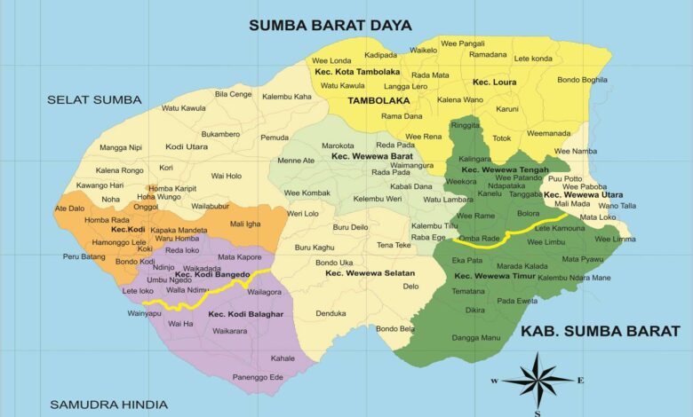
Southwest Sumba Regency is in the Lesser Sunda Islands, Southwest Sumba Regency, East Nusa Tenggara Province.
Southwest Sumba is a division of West Sumba Regency, and was formed based on Law No. 16 of 2007. The inauguration was carried out by Acting Minister of Home Affairs Widodo AS on May 22, 2007.
In 2021 the district's population will be 317.000. The government center is in the sub-district of Tambolaka City.
Southwest Sumba Regency is one of the 4 (four) Regencies on Sumba Island. Southwest Sumba Regency has a land area of 1.445,32 km² covering 11 (eleven) districts consisting of 129 villages and 2 (two) sub-districts. Geographically, Southwest Sumba Regency is located at the western tip of Sumba Island, which is precisely between 9°21'36.32″ to 9°43'37.55″ South Latitude and 118°55'40.53″ to 119°24'40.76″ East Longitude . [DDHK News]